VIIRS (Day)
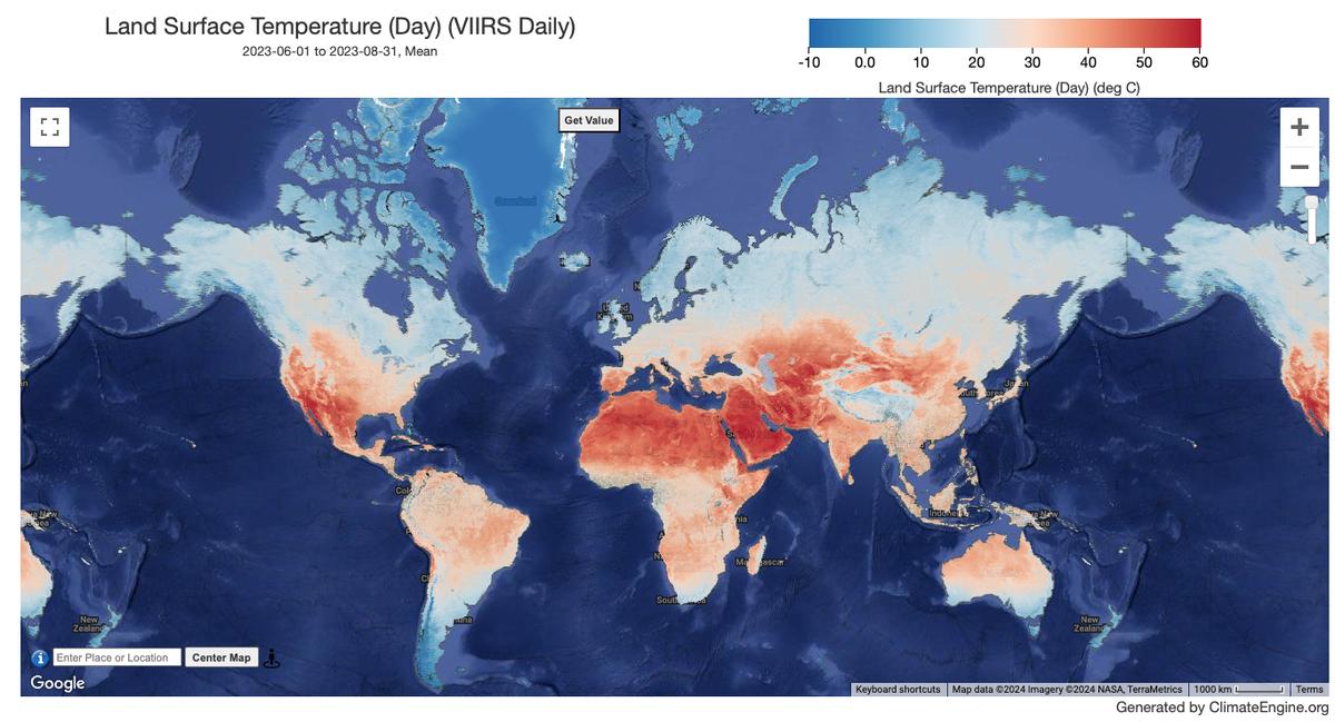
Remote Sensing · Climate Engine ID: VIIRS_DAILY
Dataset specifications
| Spatial resolution | 1km |
|---|---|
| Temporal frequency | Daily |
| Geographic coverage | Global |
| Period of record | 2012–Present |
Overview
The NASA Suomi National Polar-Orbiting Partnership (Suomi NPP) Visible Infrared Imaging Radiometer Suite (VIIRS) Land Surface Temperature and Emissivity (LST&E) Day Version 1 product (VNP21A1D) is compiled daily from daytime Level 2 Gridded (L2G) intermediate products. The L2G process maps the daily VNP21 swath granules onto a sinusoidal MODIS grid and stores all observations overlapping a gridded cell for a given day. The VNP21A1 algorithm sorts through all these observations for each cell and estimates the final LST value as an average from all cloud-free observations that have good LST accuracies. Only observations having observation coverage more than a certain threshold (15%) are considered for this averaging.
Variables
1 variable available.
| Variable | Units |
|---|---|
| Land Surface Temperature (Day) | — |
Source and access
Source catalog: Earth Engine Catalog
Earth Engine assets
NASA/VIIRS/002/VNP21A1D
Usage and attribution
Processing notes
No processing notes provided.
References
No references listed.
Terms of use
All data products distributed by NASA's Land Processes Distributed Active Archive Center (LP DAAC) are available at no charge.