Overview
Datasets
The datasets available through the Climate Engine tool and APIs are provided courtesy of dozens of data providers including NASA, the U.S. Geological Survey (USGS), the National Oceanic and Atmospheric Administration (NOAA), U.S. Forest Service, European Space Administration (ESA), European Center for Medium-Range Weather Forecasting (ECMWF), University of Montana / USDA-NRCS, University of California-Merced, Desert Research Institute (DRI), and many more.
Information about the datasets in the Climate Engine tool is available by clicking the yellow "?" icon next to the Dataset dropdown, as pictured below, which opens up a window in the tool.
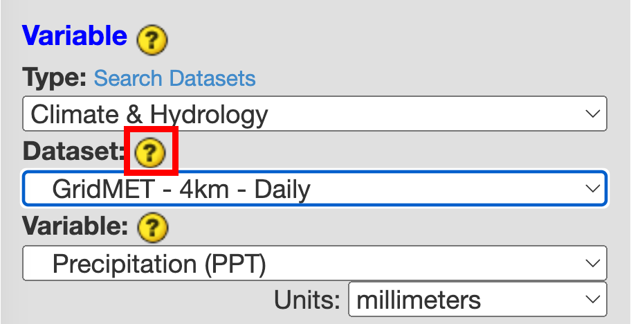
Click the yellow "?" icon to find more information about the datasets.
Metrics
Climate, vegetation, and drought can be monitored many different ways through ground observations, gridded weather and climate data, and airborne and satellite remote sensing. Access to Google Earth Engine’s satellite image and meteorological collections allow for efficient near real-time drought monitoring through statistical analyses of surface temperature, vegetation, precipitation, snow cover, surface water, soil moisture, evapotranspiration, and simple water balances.