URMA - 2.5km - Daily
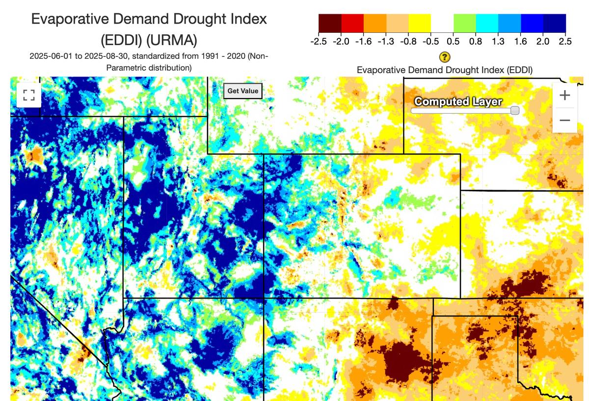
Example Jun-Aug Evaporative Demand Drought Index (EDDI) Map
Description
URMA (Unrestricted Mesoscale Analysis) is NOAA's hourly, high-resolution, near-surface "analysis of record." It reruns the RTMA system approximately six hours after each valid time, assimilating conventional, mesonet, buoy, ship, shelter, and radar-based observations that arrive too late for RTMA. This also includes advanced precipitation QPE from radar and gauge blends, and snowfall updates from NOHRSC, merged via methods like Whittaker blending. URMA uses a two-dimensional variational (2D-Var) assimilation with static background error covariances (gridpoint-statistical-interpolation, GSI) to combine observations and a first-guess model field.
Climate Engine details
- Dataset type
- Climate/Hydrology
- Climate Engine ID
- URMA
- Documentation
- No link provided
Dataset details
- Scale
- 2.5km
- Frequency
- Daily
- Coverage
- CONUS
- Start year
- 1985
- End year
- Present
Earth Engine collection details
- Earth Engine asset
- projects/climate-engine-pro/assets/noaa-urma/daily
- Earth Engine source catalog
- ClimateEngine.org
Variables
API variable docs: #unrestricted-mesoscale-analysis
| Name | Units |
|---|---|
| ASCE Alfalfa Reference ET (summed hourly) [Calculated from URMA] | N/A |
| ASCE Grass Reference ET (summed hourly) [Calculated from URMA] | N/A |
| Actual Vapor Pressure | kPa |
| Atmospheric Pressure | kPa |
| Average Daily Wind Gust 10m | N/A |
| Clear Sky Surface Short Wave solar radiation (ASCE method) | W/m^2 |
| Clear Sky Surface Short Wave solar radiation (simple method) | W/m^2 |
| Dew Point Temperature | deg K |
| Downward Surface Short Wave solar radiation | W/m^2 |
| Evap. Demand Drought Index Hargreaves (EDDI) [Calculated from URMA] | N/A |
| Evaporative Demand Drought Index (EDDI) [Calculated from URMA] | N/A |
| Extraterrestrial Solar Radiation | W/m^2 |
| Maximium Temperature | deg K |
| Maximum Daily Wind Gust 10m | N/A |
| Mean Temperature | deg K |
| Minimum Daily Wind Gust 10m | N/A |
| Minimum Temperature | deg K |
| Potential ET Hargreaves | mm |
| Specific Humidity | 1/1000 kg/kg |
| Total Cloud Cover (24 hour mean) | N/A |
| Total Cloud Cover (weighted mean by solar raidation) [Calculated from URMA] | % |
| Wind Direction | N/A |
| Wind Speed | N/A |
References
No references listed.
Website: https://www.nco.ncep.noaa.gov/pmb/products/rtma/
Processing steps
- This URMA dataset in Climate Engine combines two URMA datasets with ERA5-Land for gap-filling. From 2015 to the present, data are sourced from the public hourly URMA dataset on NOAA's AWS server, which has minor gaps (about 1%). From 1985 to 2014, data are sourced from a non-public, custom hourly URMA dataset produced by the NOAA URMA team for the U.S. Forest Service for fire index modeling, which has significant gaps (about 5%). For 1980 to 1984, no original URMA data exists, so that period was reconstructed using the same ERA5-Land bias-correction methods used elsewhere for gap-filling. 1980 -2014 URMA does not have precipitation. Gap filling was done on the daily. Gaps in the URMA data (caused by missing hours in the source data) are filled using downscaled, bias-corrected ERA5-Land data via quantile mapping (QQ mapping), though not all variables could be filled given ERA5-Land's more limited variable set. TCDC (24 hour mean), GMAX, GMIN, GAVG, and PCP are not bias-corrected, and because ERA5-Land is unavailable over the ocean, gap-filled days do not match the full spatial extent of the original URMA data. Separately, variables labeled [calculated from URMA] were computed by the ClimateEngine.org team from the URMA datasets and stored in the Google Earth Engine asset used by the Climate Engine app and API, with the solar radiation variables among these used as inputs to the ASCE Reference ET calculations.
Terms of use
OAA data disseminated through NODD are open to the public and can be used as desired. NOAA makes data openly available to ensure maximum use of our data, and to spur and encourage exploration and innovation throughout the industry. NOAA requests attribution for the use or dissemination of unaltered NOAA data. However, it is not permissible to state or imply endorsement by or affiliation with NOAA. If you modify NOAA data, you may not state or imply that it is original, unaltered NOAA data.