NCLIM
Climate/Hydrology · Climate Engine ID: NCLIMGRID_MONTHLY
Dataset specifications
| Spatial resolution | 4.6km |
|---|---|
| Temporal frequency | Monthly |
| Geographic coverage | CONUS |
| Period of record | 1895–Present |
Overview
The NOAA Monthly U.S. Climate Gridded Dataset (NClimGrid) dataset is available as either a daily (NClimGrid-d) or a monthly (NClimGrid-m) dataset. The datasets contain gridded fields and area averages of maximum, minimum, and mean temperature and precipitation amounts for the contiguous United States. NClimGrid consists of gridded fields covering the land area between approximately 24 degN and 49 degN and between 67 degW and 125 degW at a resolution of 1/24 of a degree (0.041667 deg). The primary purpose of these products is to support applications such as drought monitoring that require time series of spatially and/or temporally aggregated gridpoint values.
Variables
11 variables available.
| Variable | Units |
|---|---|
| Evap. Demand Drought Index Hargreaves (EDDI) | — |
| Maximum Temperature | K |
| Mean Temperature | K |
| Minimum Temperature | K |
| Potential ET Hargreaves | mm |
| Potential ET Thornthwaite | mm |
| Potential Water Deficit Hargreaves | mm |
| Precipitation | mm |
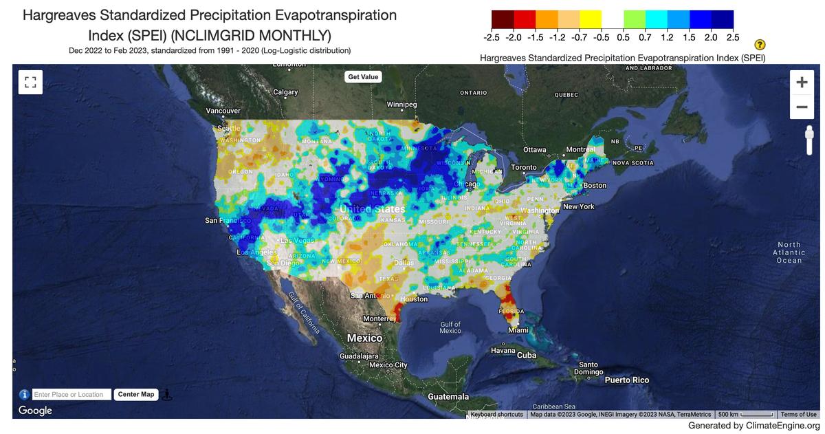
| Standardized Precipitation Evapotranspiration Index Hargreaves (SPEI) | — |
| Standardized Precipitation Evapotranspiration Index Thornthwaite (SPEI) | — |
| Standardized Precipitation Index (SPI) | — |
Source and access
Source catalog: ClimateEngine.org
Earth Engine assets
projects/climate-engine-pro/assets/noaa-ncei-nclimgrid/monthly
Usage and attribution
Processing notes
No processing notes provided.
References
- Vose, Russell S., Applequist, Scott, Squires, Mike, Durre, Imke, Menne, Matthew J., Williams, Claude N. Jr., Fenimore, Chris, Gleason, Karin, and Arndt, Derek (2014): NOAA Monthly U.S. Climate Gridded Dataset (NClimGrid), Version 1. [indicate subset used]. NOAA National Centers for Environmental Information. DOI:10.7289/V5SX6B56 [access date]
Terms of use
NOAA and NCEI cannot provide any warranty as to the accuracy, reliability, or completeness of furnished data. Users assume responsibility to determine the usability of these data. The user is responsible for the results of any application of this data for other than its intended purpose. NOAA and NCEI make no warranty, expressed or implied, regarding these data, nor does the fact of distribution constitute such a warranty. NOAA and NCEI cannot assume liability for any damages caused by any errors or omissions in these data.