CEMS Fire Danger Indices
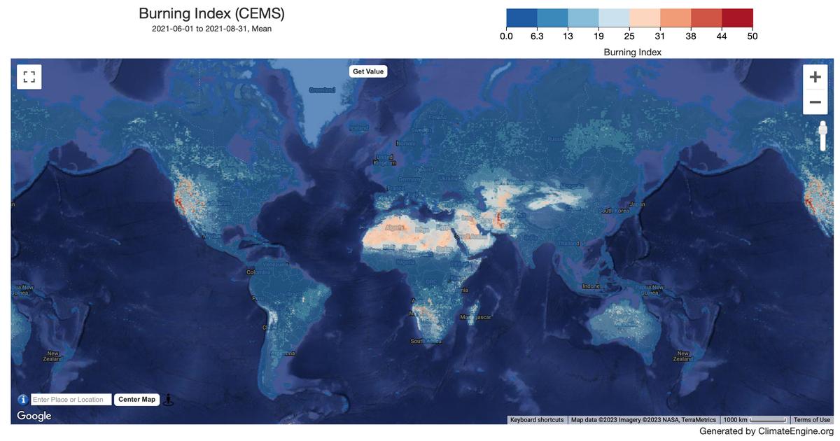
Climate/Hydrology · Climate Engine ID: CEMS
Dataset specifications
| Spatial resolution | 24km |
|---|---|
| Temporal frequency | Daily |
| Geographic coverage | Global |
| Period of record | 1940–Present |
Overview
Fire danger indices from the ECMWF, calculated using weather forecasts from historical simulations provided by ECMWF ERA5 reanalysis.
Variables
12 variables available.
| Variable | Units |
|---|---|
| Build-up Index | Dimensionless |
| Burning Index | Dimensionless |
| Danger Risk | Dimensionless |
| Drought Code | Dimensionless |
| Duff Moisture Code | Dimensionless |
| Energy Release Component | J/m^2 |
| Fine Fuel Moisture Code | Dimensionless |
| Fire Daily Severity Rating | Dimensionless |
| Fire Weather Index | Dimensionless |
| Ignition Component | Percent |
| Initial Fire Spread Index | Dimensionless |
| Spread Component | Dimensionless |
Source and access
Source catalog: ClimateEngine.org
Earth Engine assets
projects/climate-engine-pro/assets/ce-cems-fire-daily-4-1
Usage and attribution
Processing notes
No processing notes provided.
References
- Vitolo, C., Di Giuseppe, F., Barnard, C., Coughlan, R., San-Miguel-Ayanz, J., Liberta, G., & Krzeminski, B. (2020). ERA5-based global meteorological wildfire danger maps. Scientific data, 7(1), 1-11. 'Contains modified Copernicus Climate Change Service information [Year]'
Terms of use
Find license information here: https://cds.climate.copernicus.eu/api/v2/terms/static/licence-to-use-copernicus-products.pdf